Recommended Articles

The ultimate foodie’s guide to Toronto
Time to get away – Prince Edward County and Chelsea
Five unusual ways to budget for your trip
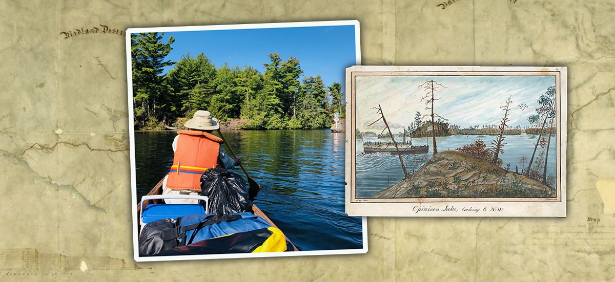
Above: On day three of their adventure, Dan and his friend Bill approach Opinicon Lake. (RIGHT) Opinicon Lake looking to the N.W." by Thomas Burrowes, 1840, www.archives.gov.on.ca. (BACKGROUND IMAGE) Mr. Samuel Clowes, "Map of the proposed Canal for uniting Lake Ontario with the River Ottawa by way of the Rivers Catarcquay, Gananoque and Rideau surveyed in the years 1823 and 1824", 1824, Library and Archives Canada, H1/410/Rideau Canal/1824, NMC 11962 .
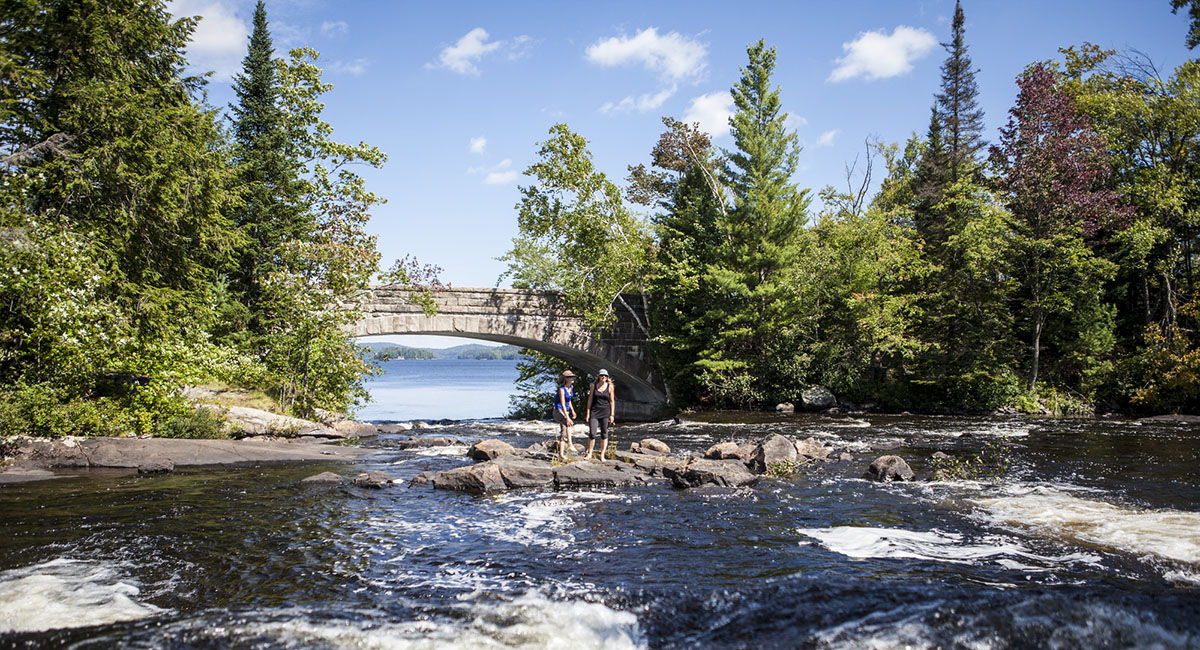
Travel restrictions over the past year have sharply curtailed vacation options that feed our appetite for natural beauty, for escape and for discovery, to learn about history, and for friendship through shared adventures. As Canadians and Ontarians, we’re fortunate to have destinations in our backyard that check all these boxes. And so it was on a warm, sunny but breezy Monday last September, my friend Bill and I slipped our canoe off the dock at Kingston Mills Lock to begin a five-day journey up the historic Rideau Canal system to Poonamalie Lock, a few kilometres below Smiths Falls. In socially-distanced Ontario, this was the perfect vacation, and September was the ideal time with river traffic light, and the bugs few and far between.
Led by Colonel John By of the British Royal Corp of Engineers, workers carved the 202 kilometre nautical route out of the wilderness. In the anxious period following the War of 1812, the waterway would allow troops and supplies from Montreal to reach Kingston and other communities in Upper Canada without being subject to possible American attack along the St. Lawrence River. The waterway is now the Rideau Canal National Historic Site, received a UNESCO World Heritage Site designation in 2007, and remains the only full operational early 19th Century canal in North America. As Parks Canada further articulates its commitment to Reconciliation, it will be interesting to see more interpretation of the lives lived by Indigenous people in this region over the millennia.
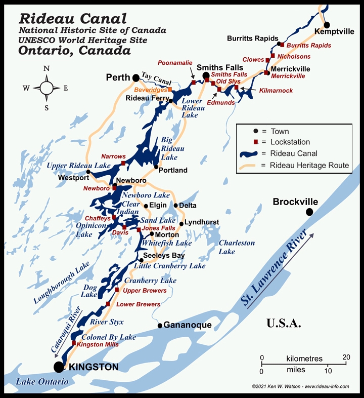
Map by Ken W. Watson • www.rideau-info.com
The canoe perspective highlights the dramatic landscape changes as the marshy creeks of the St. Lawrence Lowlands transition quickly to the rock of the Frontenac Arch Biosphere; a spine of Precambrian rock of the Canadian Shield that gives way once again to farmland below Smiths Falls. The canoe route meanders through narrow river channels, across small lakes and thence on to the larger Rideau Lakes. The first third or so of the route follows the rough outline of the Cataraqui River system. Colonel By didn’t just build a canal; he created a mosaic of lakes by flooding swamps and changing the courses of waterways.
Day 1 took us 18 kms north from Kingston Mills, to the Upper Brewers lock. Padding against a stiff breeze and chop on Colonel By Lake, we passed Joyceville prison poised high up on the bank; I envisioned prisoners facing the river, amidst the drudgery of prison life actually appreciating their water view. Passing through a narrow serpentine gut, we entered the River Styx. Steering around stumps and deadheads (a vertically floating log), we re-entered the Cataraqui River, portaged at Lower Brewers, and landed at the upper lock station. With the exception of two other paddlers, and a large cabin cruiser tied up at mooring, we had the lock to ourselves. Pitched our tents, we prepared an easy-to-fix dinner, and talked until the mist started to rise from the water.
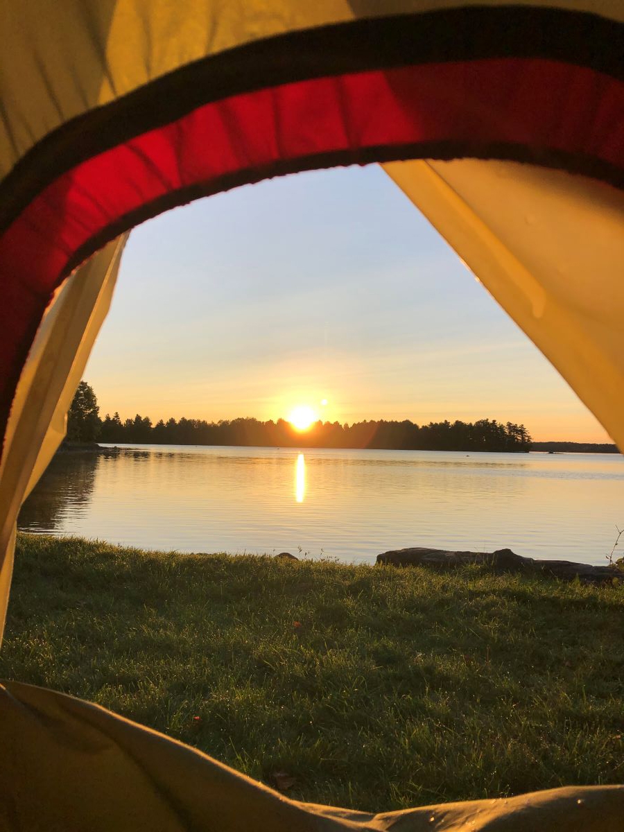
ABOVE: Sunrise on Colonel By Island.
For the first 100 years or so of Confederation, Canal administration fell first to the Department of Railways and Canals and then to the Transportation ministry. Parks Canada took responsibility in 1972, and their friendly and knowledgeable staff does an outstanding job. Canada’s best kept secret, camping reservations can be made by bike or water-travellers at the lock stations for $5 per night per person – including real washrooms with hot water! Reservations for this paddling season now open. Further information is available at Paddling – Rideau Canal National Historic Site (pc.gc.ca)
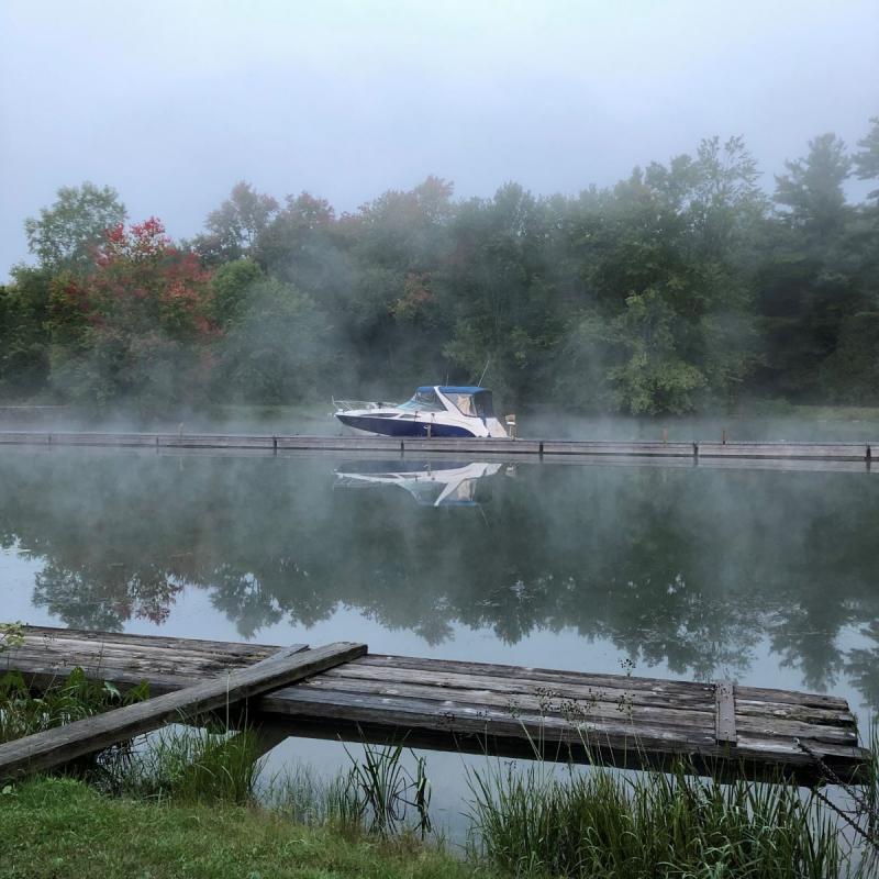
Above: Morning mist at Upper Brewers Lock.
The fog burned off quickly on day 2, as the waterway transitions from Cranberry Lake, to Little Cranberry Lake. Once known as Cranberry Swamp; Colonel By nearly died from the ‘fever’ contracted in this area. At the top of Little Cranberry, the channel narrows again, and we found ourselves amongst a series of islands. Directional signs pointed east to Seeleys Bay, and though tempted by an ice cream, we decided to forgo the additional kilometres that would add to our day. Another narrow gut brought us into Whitefish Lake, at the top of which off to the east, looms Rock Dunder, one of the highest elevations in the area and a popular hiking destination. We paddled in around Deans Island but confronted by a near sheer cliff, we couldn’t find a spot to hike in from, so we continued on to Jones Falls.
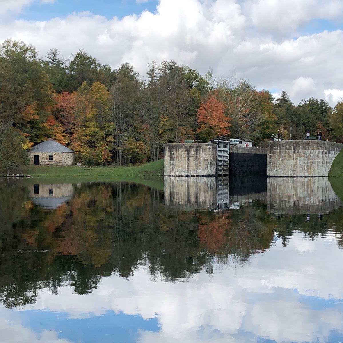
Above: Approaching the fourth lock at Jones Falls.
Rounding a bend to our left, the front triple-locks at Jones Falls rose into view like a cathedral of the wilderness. Off to our right were a collection of cottages and with paint-peeling but still stately, the Hotel Kenney. The locks date from the early 1830s, and the hotel from 1877. There’s a majesty to the locks that you can’t fully appreciate when walking alongside, but from the vantage point of a canoe, the granite blocks and wooden gates soar fifty feet in the air. I felt we’d been transported back in time.
The Jones Falls locks were designed to bypass a 20-metre waterfall, so rise in three tiers, with a fourth lock in behind. The stone arch dam completed in 1831, was once the largest such dam in what is now Canada, and the 3rd highest in the world. Granite blocks that comprise the dam were hauled to the site by oxen from Elgin, 9 kms away. Imagine this spectacular engineering project in the 1830s far from nowhere. The station also includes a blacksmith shop and perfectly preserved defensible blockhouse guarding the approaches. A highlight for me was watching Bill portage the canoe classic-style on his shoulders uphill for nearly 300 metres! We were blessed with beautiful sunny days – mid to high teen temps for paddling- but it was getting colder at night!
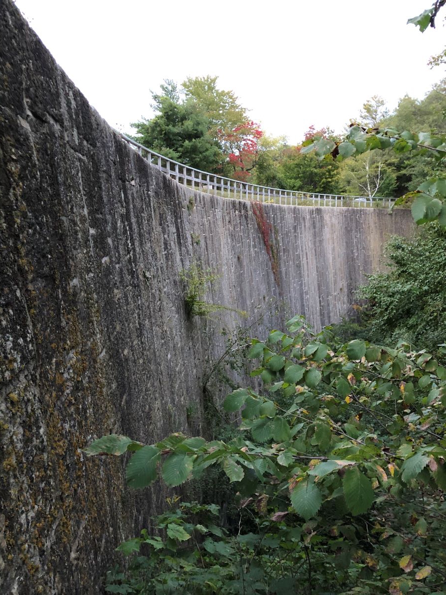
ABOVE: The stone arched dam wall at Jones Falls.
Day 3 was the shortest paddle of the trip at about 11 km but perhaps the prettiest. We entered Sand Lake; a small lake but scenic with many islands. More serpentine turns took us into the windy middle of the lake. The beauty of the canoe is that you don’t need to follow the navigational channel. So, we tacked west in behind Birch Island to find smoother water. Exploring the island’s tip, we found a short causeway with rusty culverts running underneath. Rather than paddle back down the lake or unpack the canoe for a portage, we pulled ourselves through one of culverts. I prayed that culvert would hold for 2 minutes more! Much to our chagrin, we later discovered that if we had gone another 100 metres, we would have found a safer water passage! Lunch was at Davis Lock, a very pretty spot. From Davis, it’s a short paddle through a series of islands into Opinicon Lake. We were met halfway across the lake by our host for the evening in his pontoon boat, and shielded from the wind, were escorted into the canoe dock at Chaffey’s Lock.
Rick and his wife Celine have skillfully restored the 1870s grist mill by the lock; the new copper roof gleams in the sunshine. The Mill houses an art gallery featuring original oil and watercolour paintings by Ontario artists. Artists appear throughout the season to showcase their works. Lockdowns haven’t stifled artistic creativity – be sure to check it out this summer! Dinner was fresh Rick-caught lake bass, and the evening ended with our feet up, and heads nodding in front of a crackling fire.
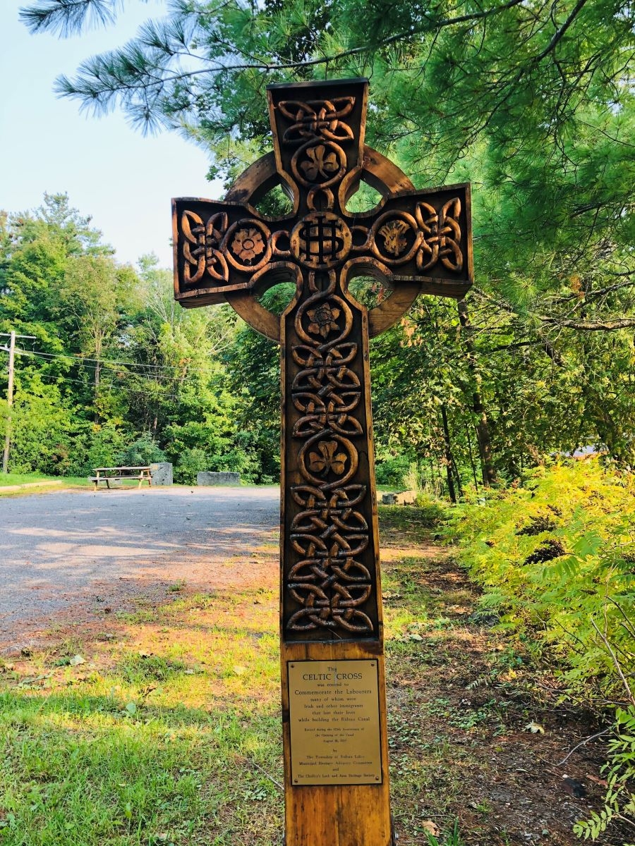
ABOVE: A memorial to the labourers who died building the Rideau Canal.
Chaffey’s Lock village is perfect for a walking tour. From the Mill, you cross a swing bridge with the old Lockmaster’s House on your left. Straight ahead, the green sweep of the lawns of the restored Opinicon Hotel beckons with its outdoor pool overlooking the lake. The pioneer cemetery includes the graves of nearly 80 labourers, primarily Irish who died building the Canal. I thought of young Irishmen disembarking ships in Quebec City, travelling to the wild forests of Upper Canada. Dying in their hundreds from malaria, black powder blasting, rock falls and the cold, they were then laid in graves marked only by a rock. Unknown in their new homeland, with their families on the Emerald Isle never to know of their fate.
Day 4 brought us fully into lake country; Indian, Clear and Newboro Lakes. Punctuated by islands, bays, points and rocks, this stretch is especially scenic. Newboro Lock marks the summit of the Rideau Canal, and is the division between the Cataraqui and Rideau Rivers. Paddling through Upper Rideau Lake. the pretty town of Westport lies off to the west. We had fortuitous timing at the Narrows as we were able to avoid a short portage by piggybacking a float through the lock with a larger boat. From there, we hugged the western shore of Big Rideau Lake for 90 minutes, and arrived at Colonel By Island.
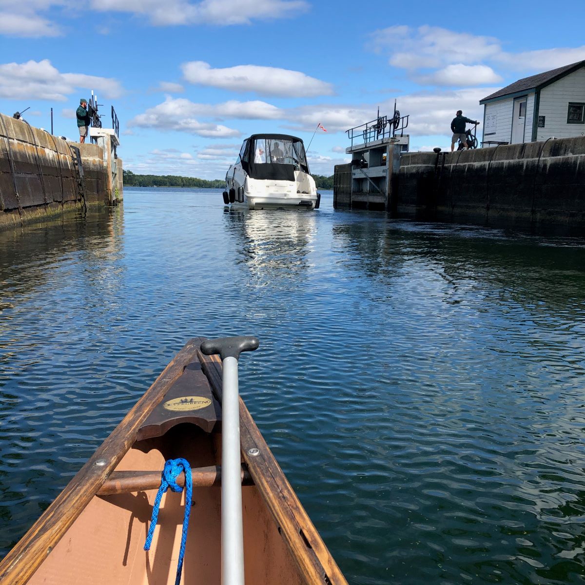
ABOVE: Paddling out of the locks at the Narrows.
Lying in a cluster of islands several kms northwest of Portland, it was previously owned by American Daniel Arnstein, then a co-owner of Yellow Cab in New York and Chicago. He built a sprawling ‘cottage’ with large stone chimneys that leave one imaging the size of the indoor fireplaces. Once a magnet for celebrities, the building has fallen into disrepair. Now owned by Parks Canada, the island is a beautiful place to camp whether paddling the Rideau or coming over from Portland for the night. With the exception of one cabin cruiser, and a curious raccoon, we had the island to ourselves. The stars were out in full force that night, with the Milky Way brilliant in a fashion unseen in Ottawa.
Friday was the longest, most strenuous day of the week, traversing the remainder of Big Rideau Lake, past Rideau Ferry into Lower Rideau Lake. The navigation channel distance for the day is about 25kms but with the wind in our face most of the day, it felt like 30! The day’s paddle challenged us as we wove our way through islands and narrow channels with thousands of J strokes, seeking some relief from the wind in our face. Passing Murphy Point Provincial Park, the shoreline is alternately rocky with sandy beaches, one of which was a perfect stop for lunch. Following a quick stop at Rideau Ferry and a Coke, we plunged into the final stretch of Lower Rideau Lake, which is incredibly marshy at its upper reaches. Flocks of cormorants accompanied us. The final paddle strokes to Poonalmalie were leisurely and allowed us a very relaxed finish to the day, and our trip.
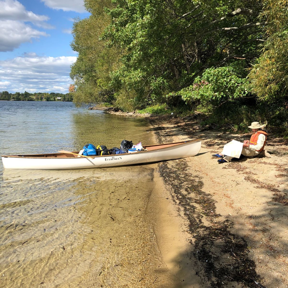
ABOVE: Lunch on the sand at Murphy Point Provincial Park.
The Rideau waterway remains an engineering marvel, and its locks and buildings endure as architectural inheritances. But its full value transcends historical and environmental significance. Nearly two centuries on, we can experience these rivers and lakes in a very intimate fashion; not just as tourists but as citizens, and custodians. Pierre Elliott Trudeau wrote 80 years ago that, “I know a man whose school could never teach him patriotism, but who acquired that virtue when he felt in his bones the vastness of his land, and the greatness of those who founded it”. In this Covid-year, five days on the water brought me much closer to the land we call Canada.
ALL PHOTOS: DAN McCARTHY